Munin Member
Viking Group, Draupne Formation
Unit definition
The name Munin has been used in the literature as informal name for intra Draupne sandstones in the
Northern North Sea area (Millennium Atlas). Originally the name was introduced by Statoil workers for
sands encountered in two wells in block 33/9 on Tampen close to the Statfjord North Field. The unit
has not been formally defined previously.
Name
The unit has previously been referred to as 'Intra Draupne Sandstone' or 'Upper Draupne Sandstone' as
well as 'Munin Sands' or 'Munin Sandstone'.
In publications this unit has been referred to as the informally defined 'Munin Sands' by Glennie
(1998) without further reference to source of the name. In the Millennium Atlas the term 'Munin
Sandstone Member' has been applied to all intra Heather and Draupne Formations sandstones.
Derivatio nominis
The name of this member derives from the name of one of the two ravens that the Nordic God Odin used
for telling him news about the world. The ravens flew across the earth and returned to sit on Odin's
shoulders to report news. The other raven was called Hugin. Unfortunately Hugin has been used for one
of the formations of the Vestlandet Group.
Type well
Norwegian well 33/9-15.
Depth 2743-2841 mRKB. WGS84 coordinates N 61°24'24.67"; E 1°57'15.76".
UTM coordinates 6808715.45 N, 444170.28 E, zone 31.
Location of type well.
|
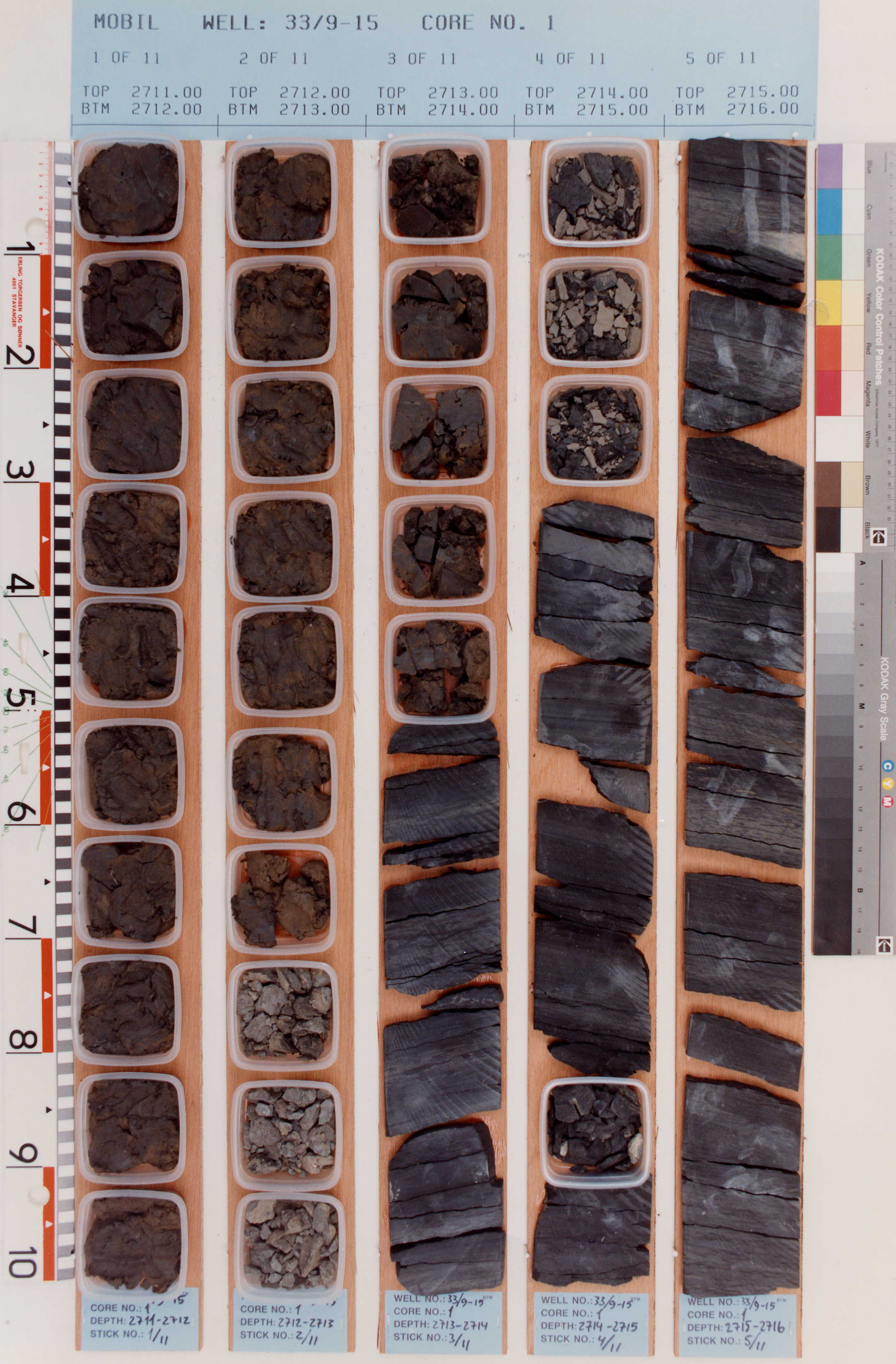
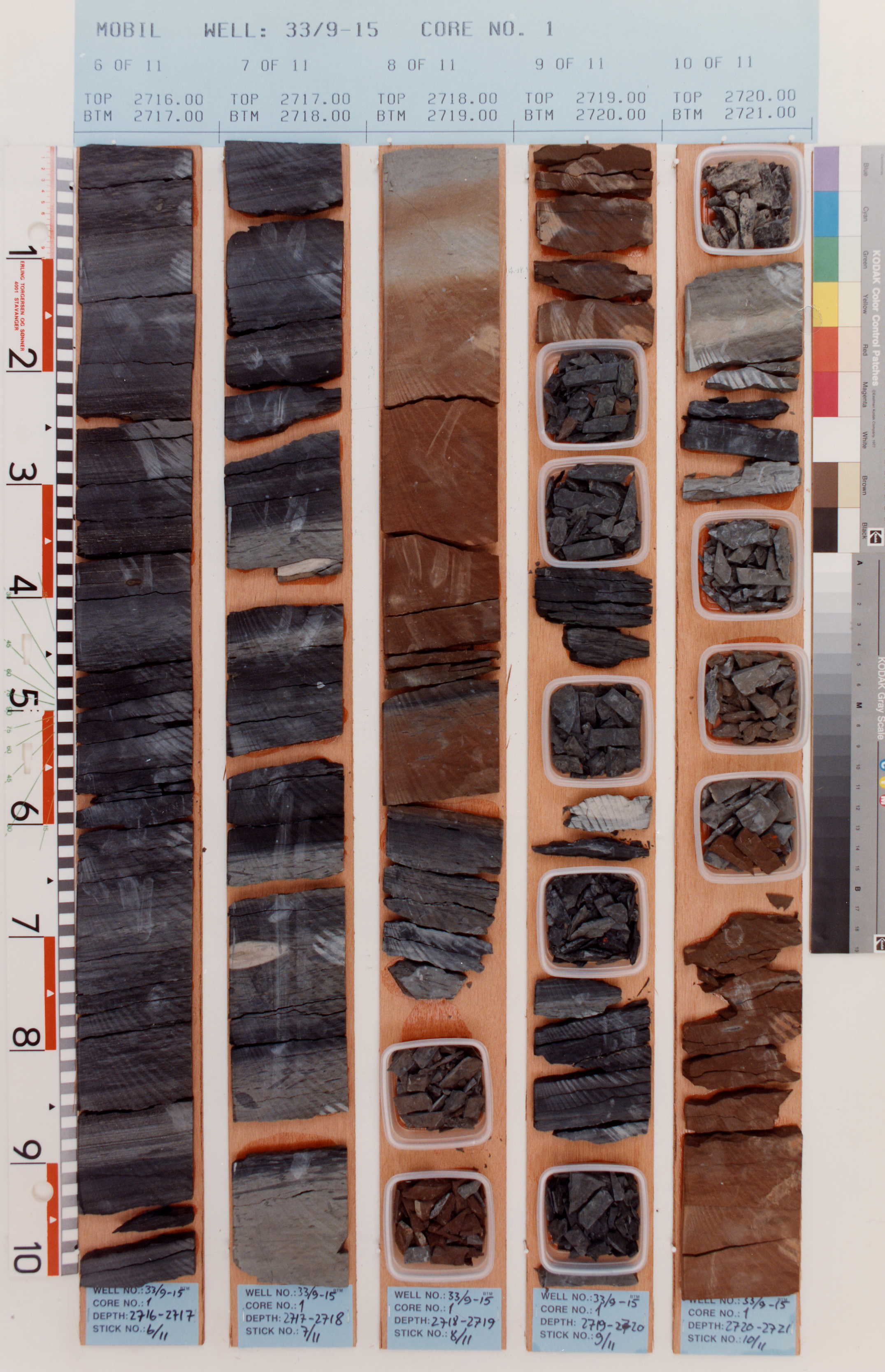
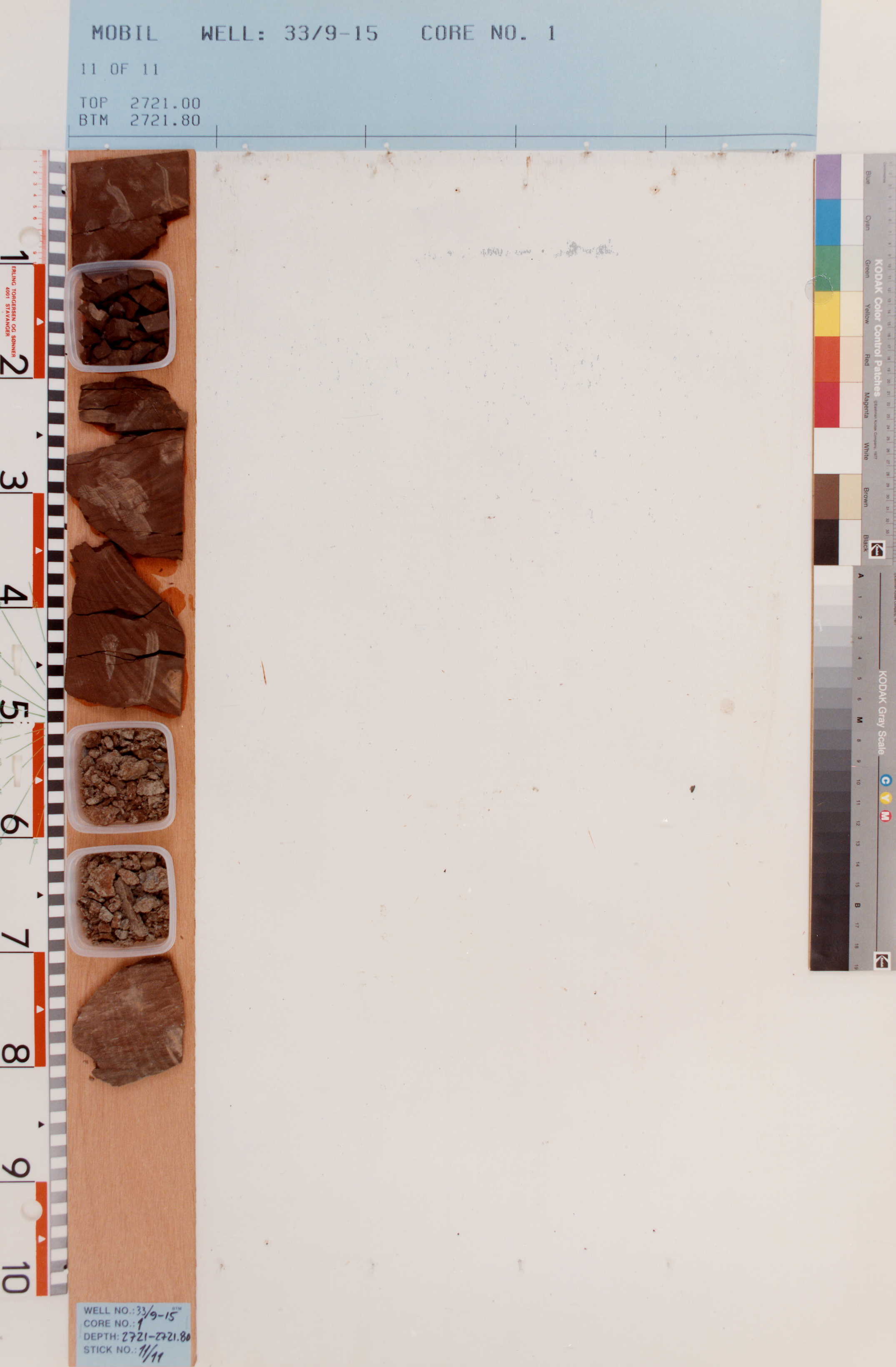
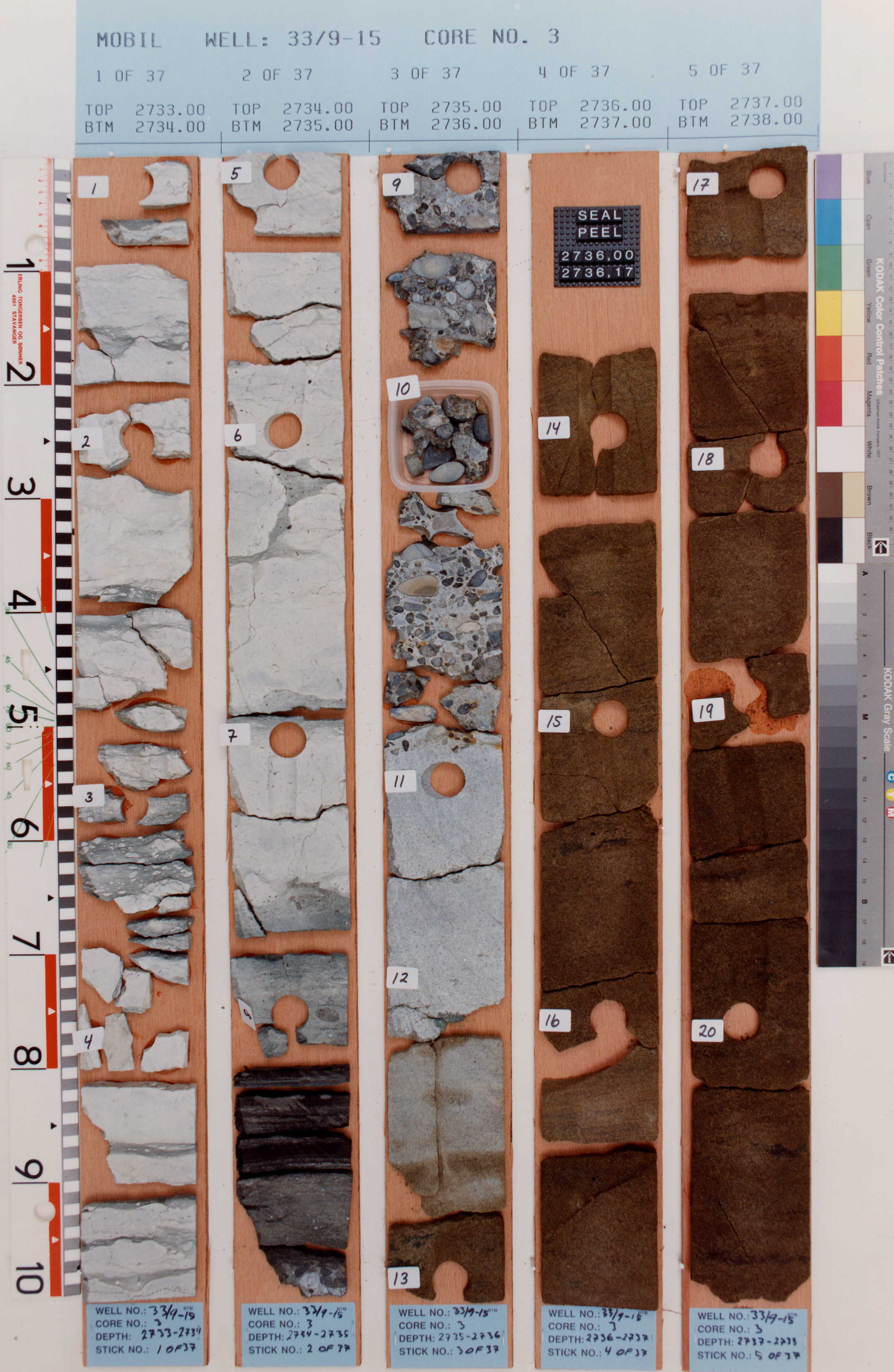
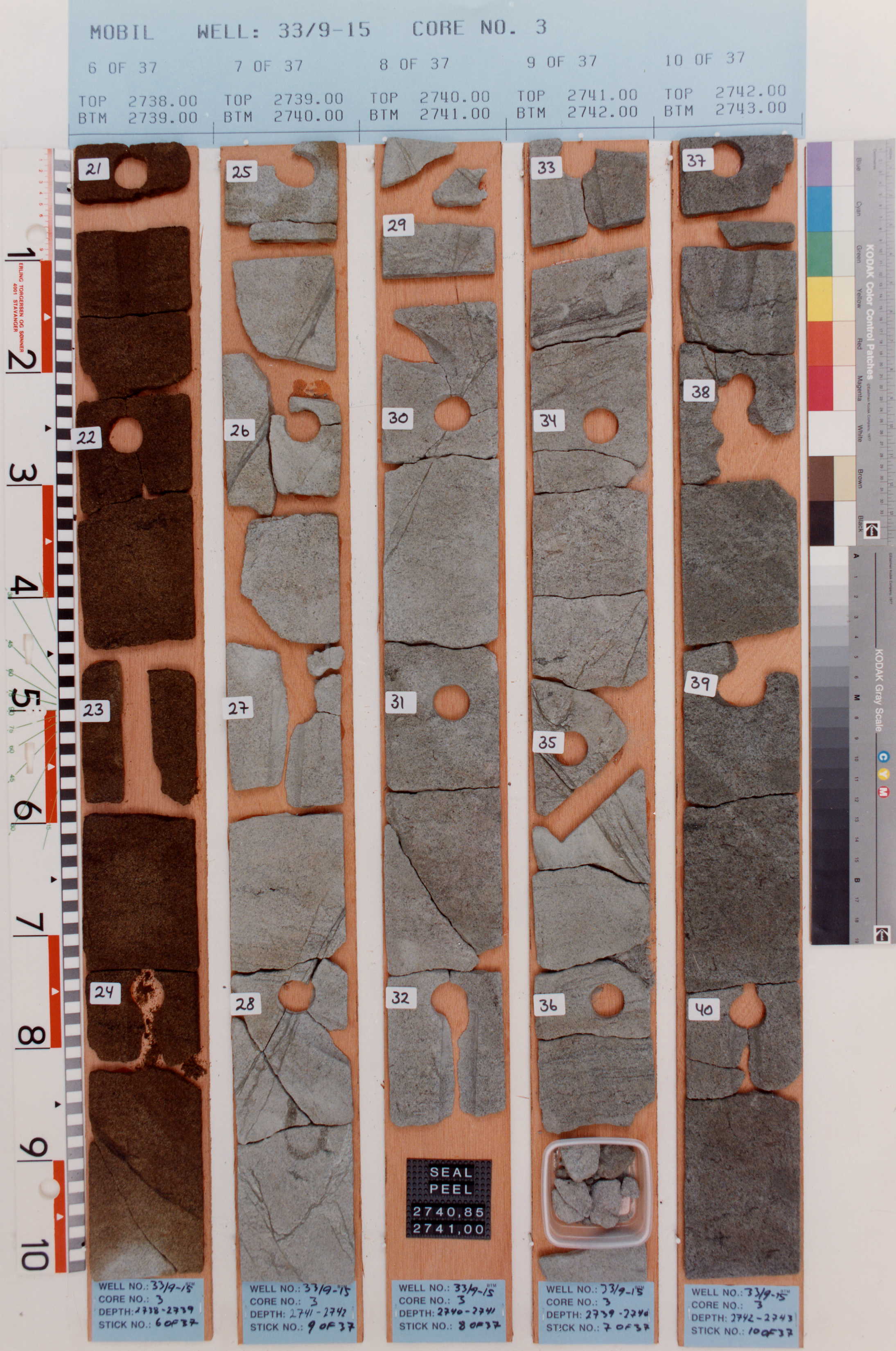
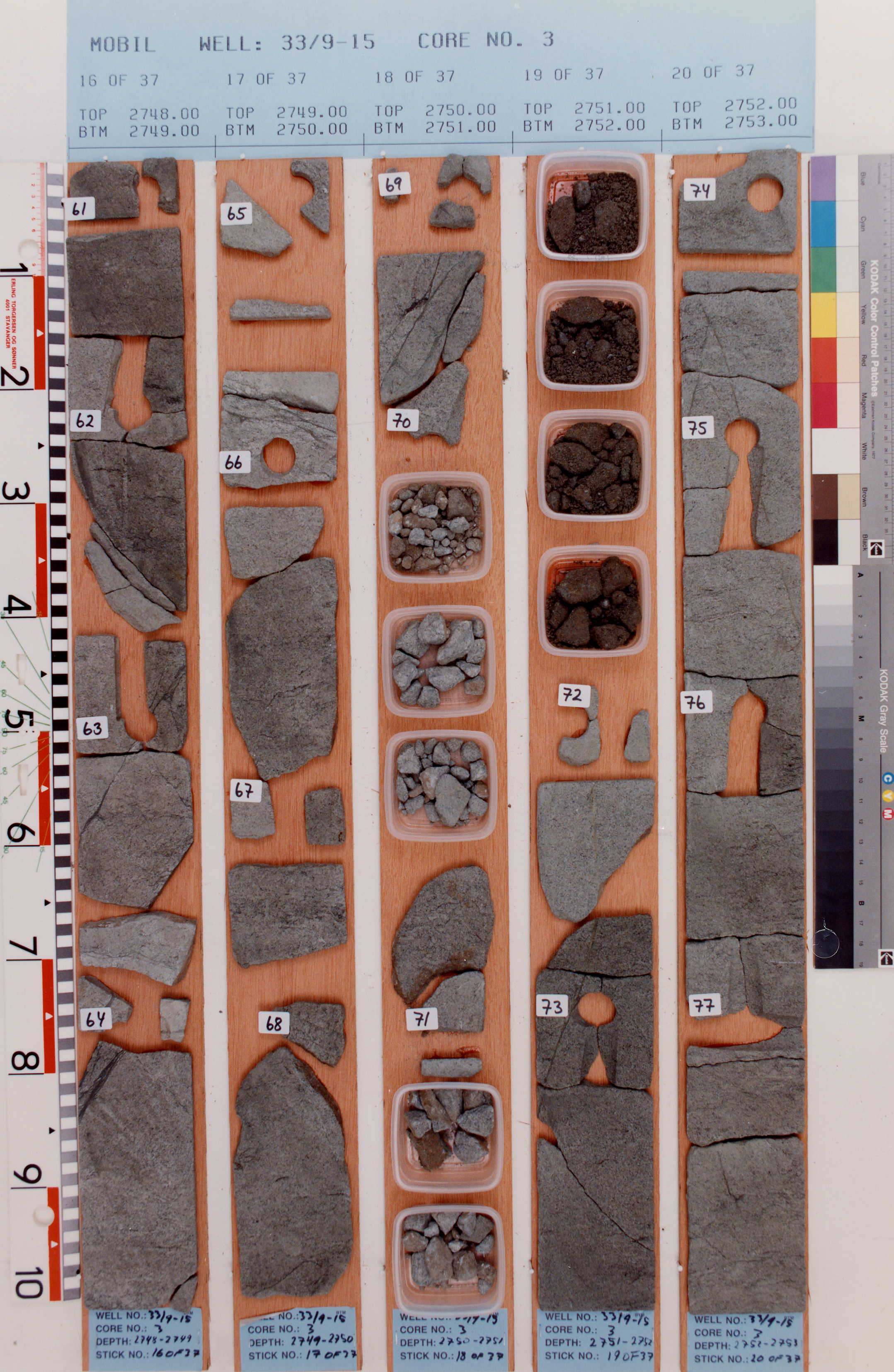
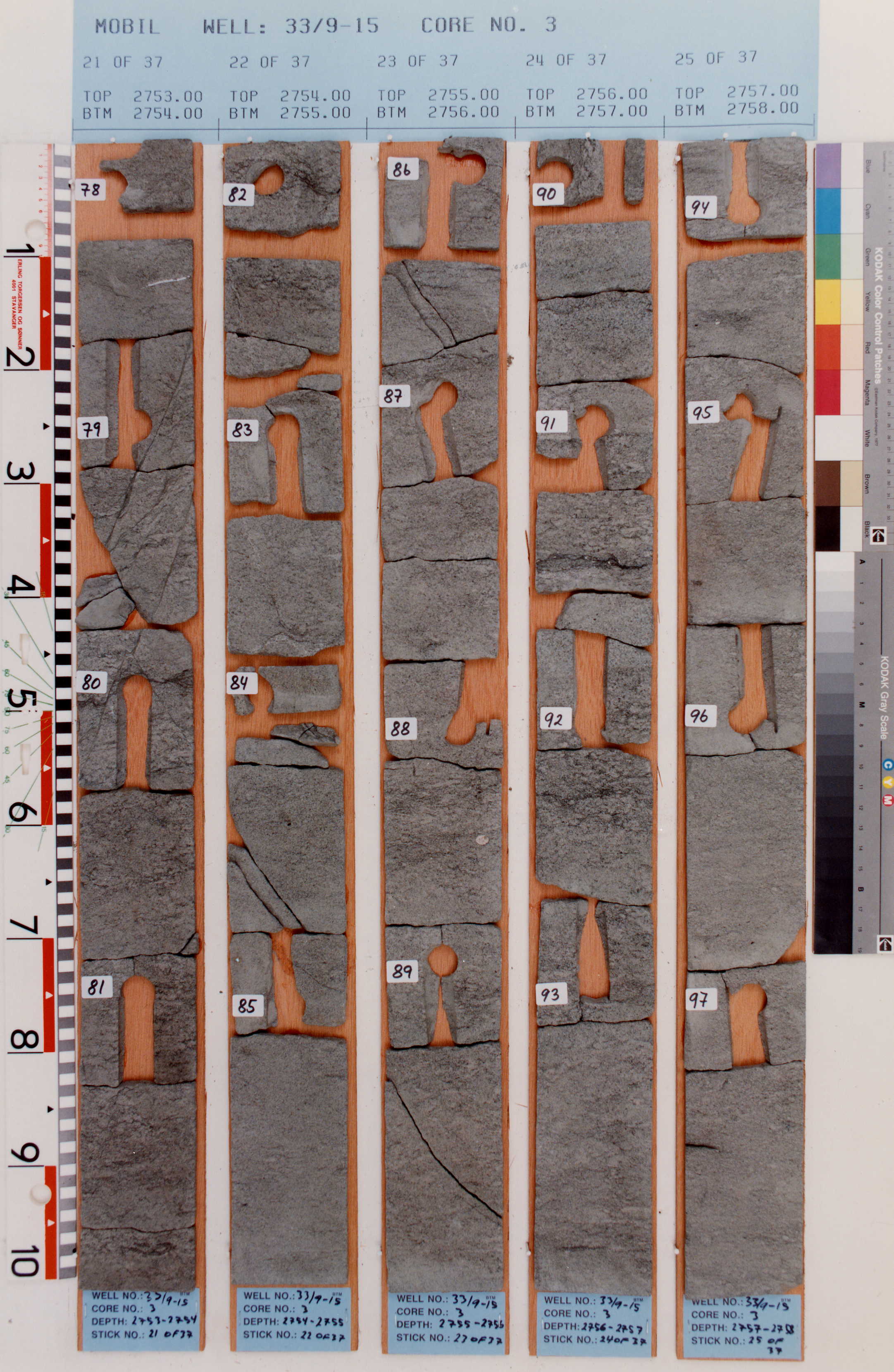
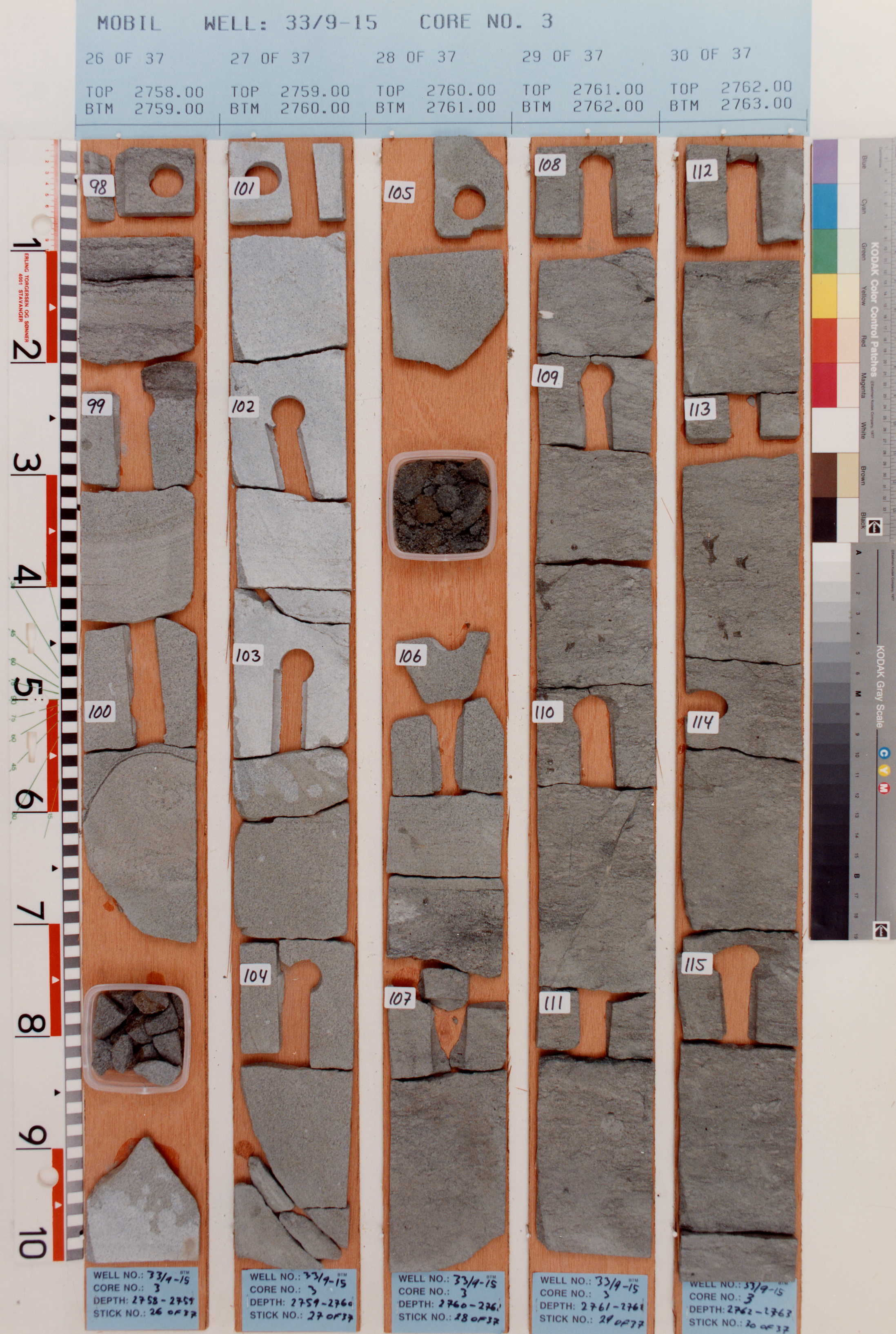
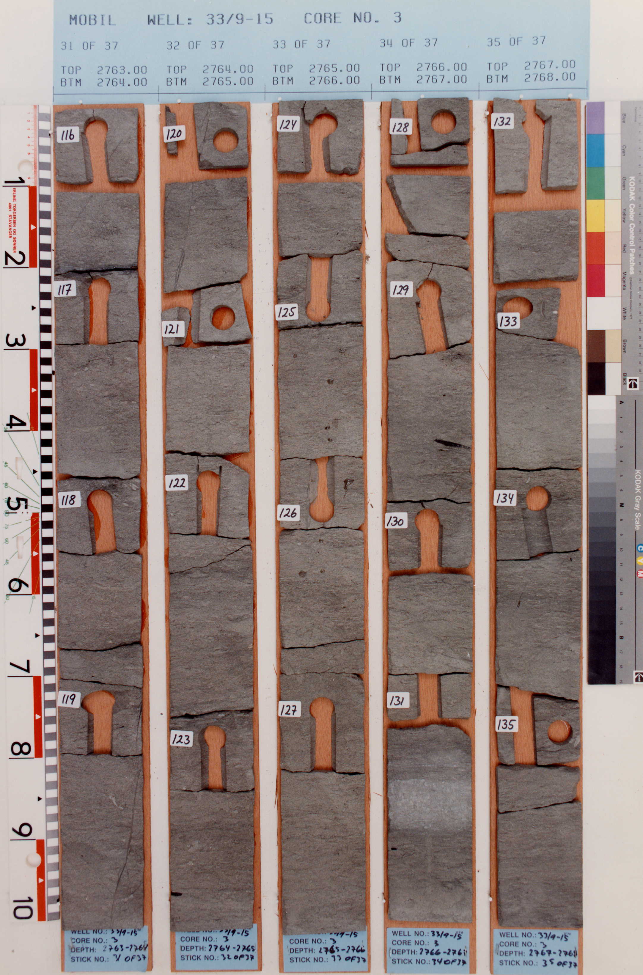
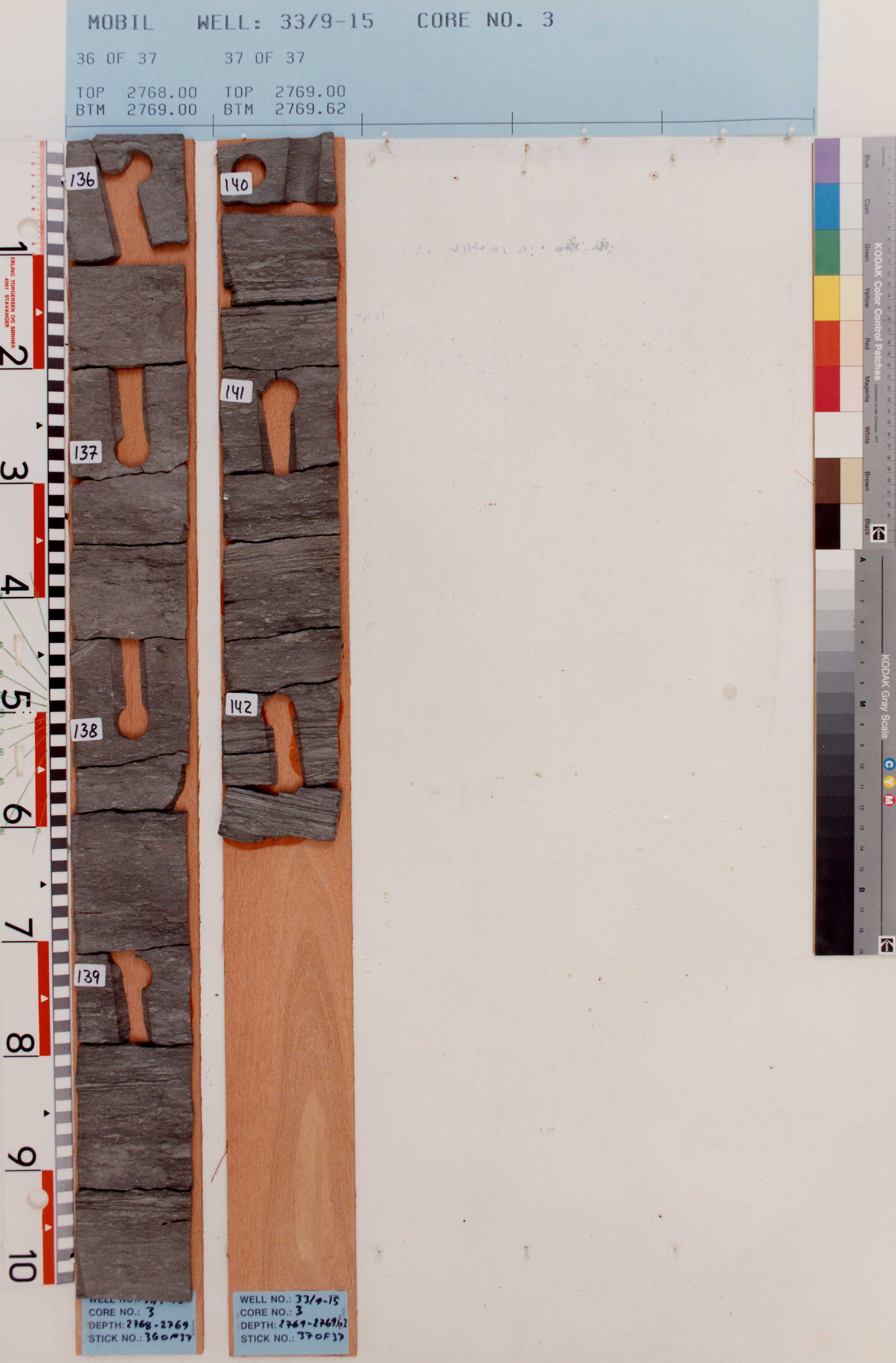
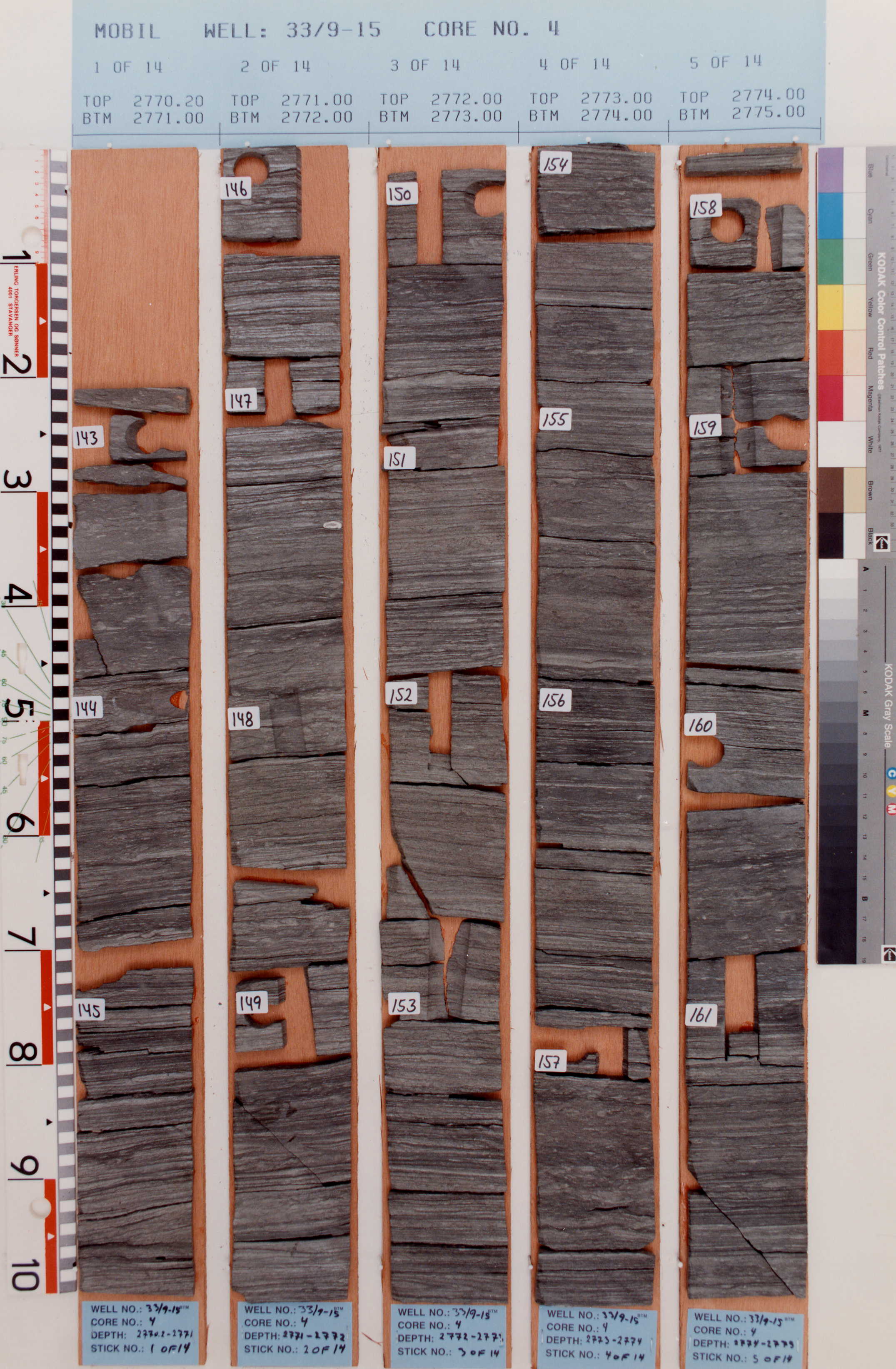
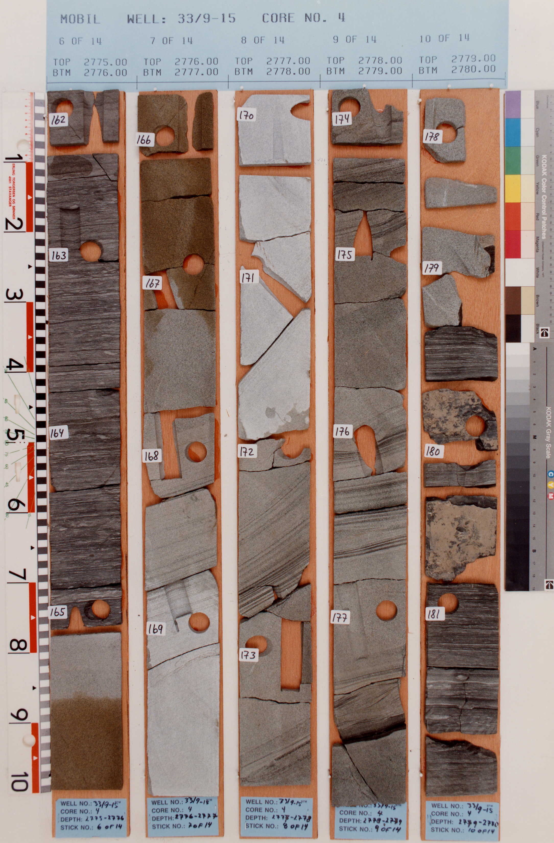
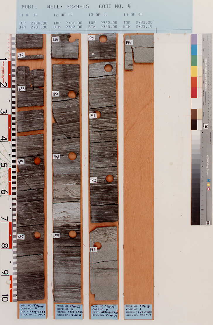
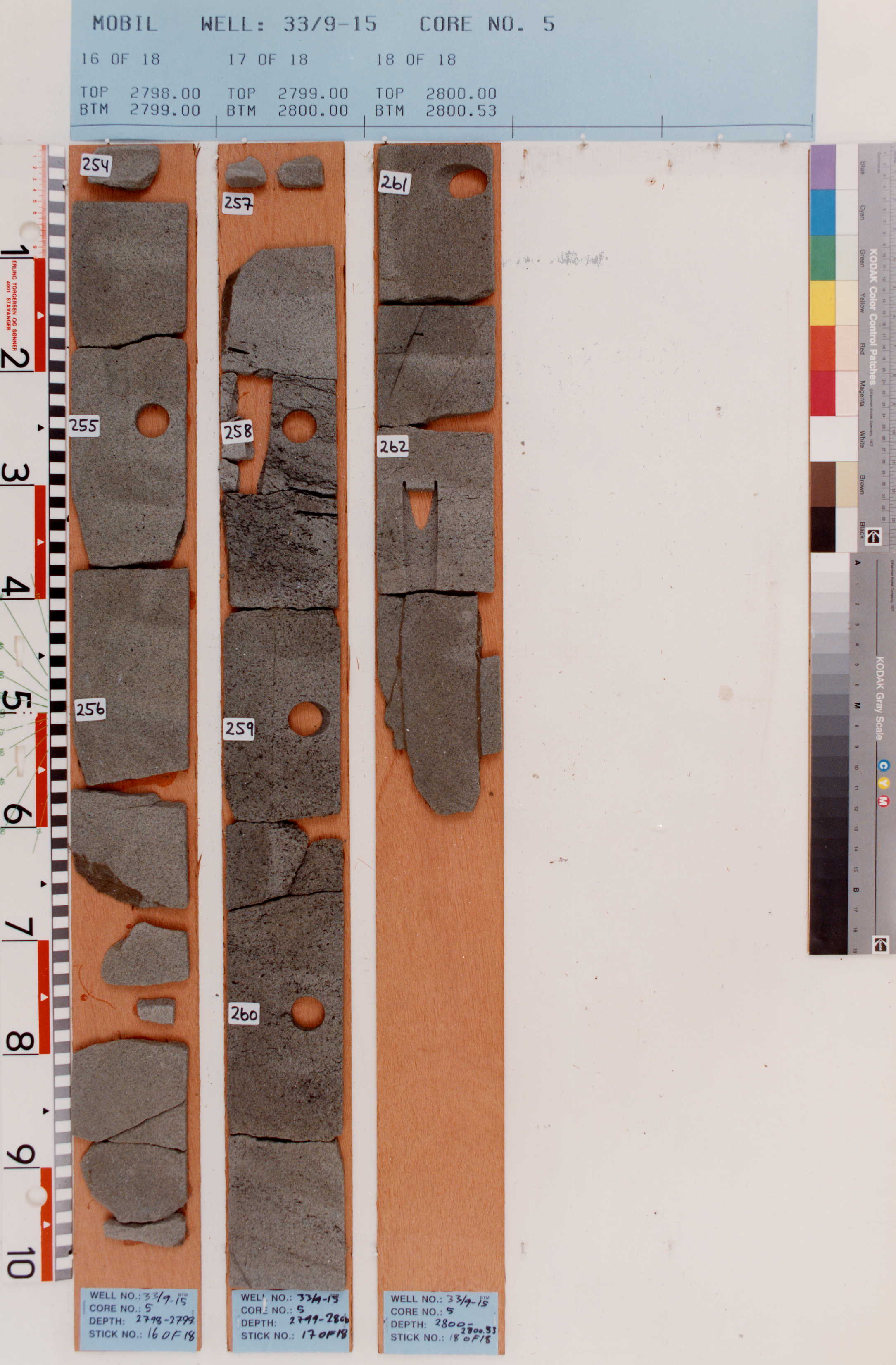
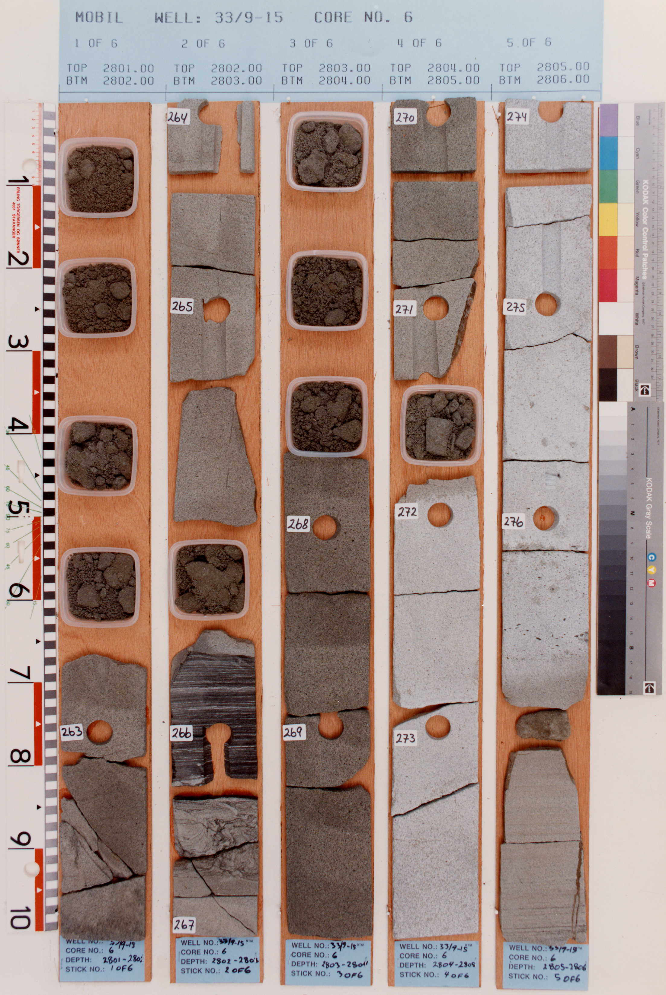
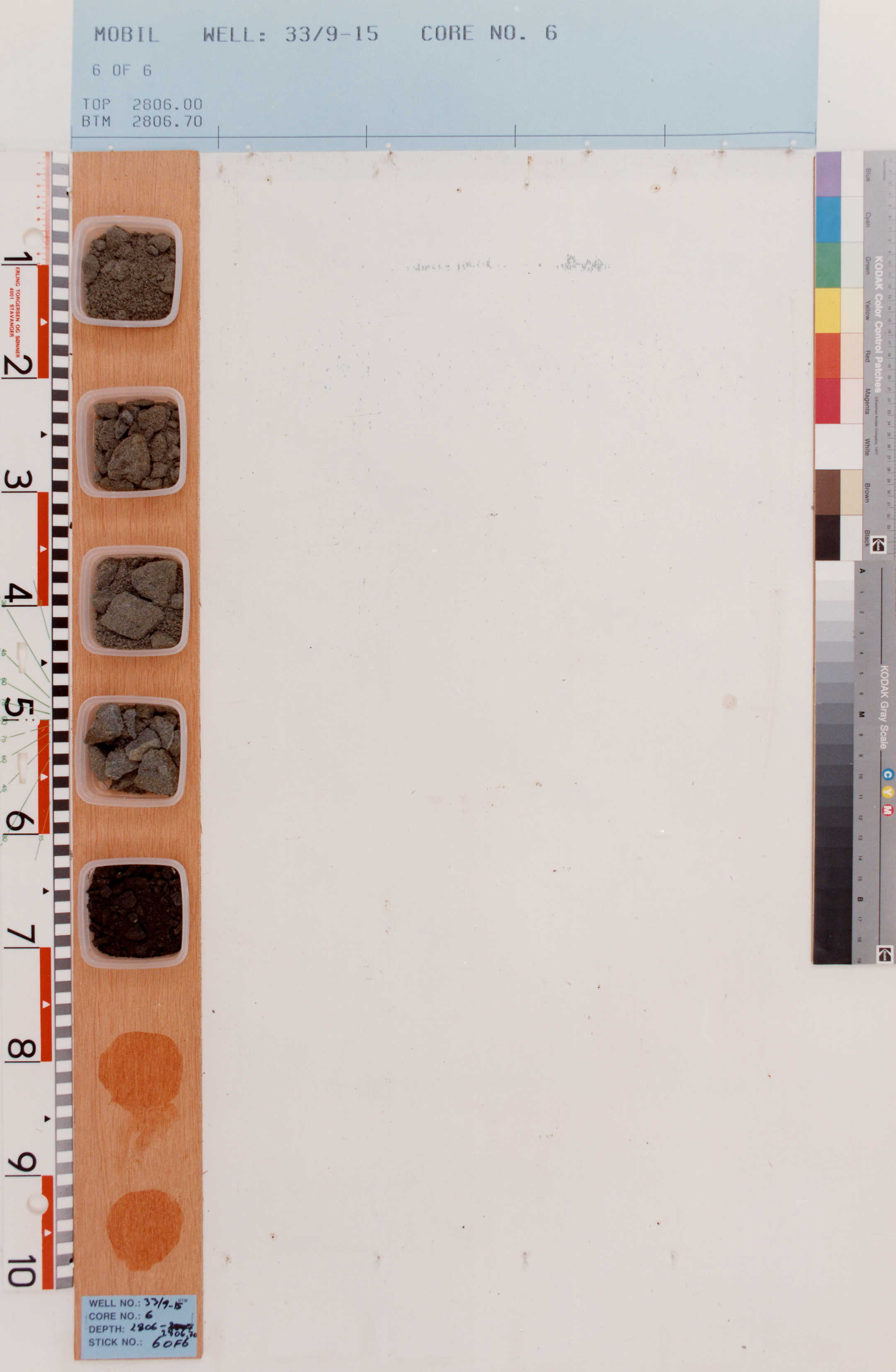
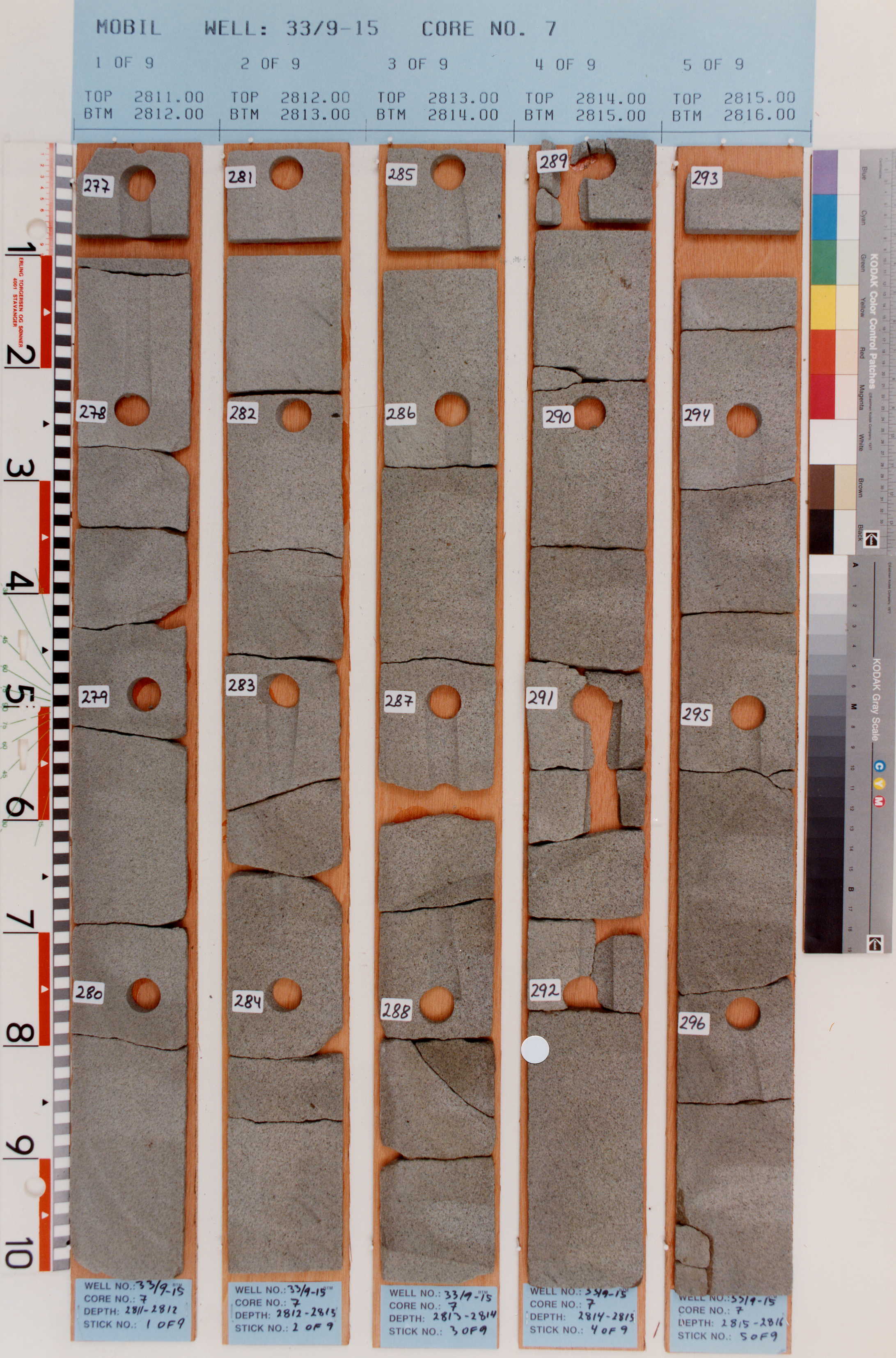
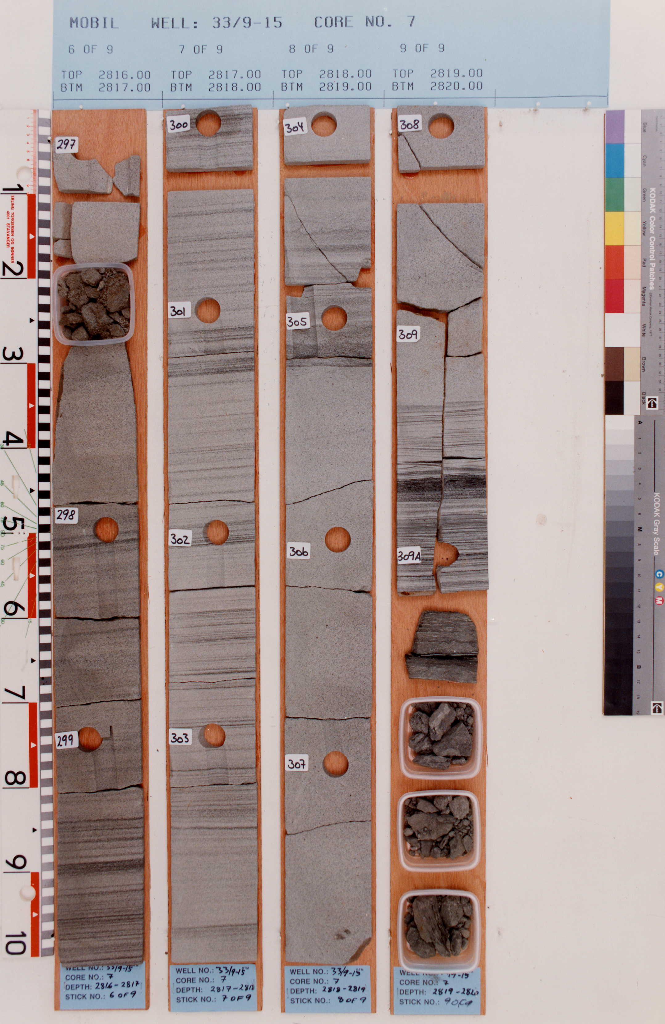
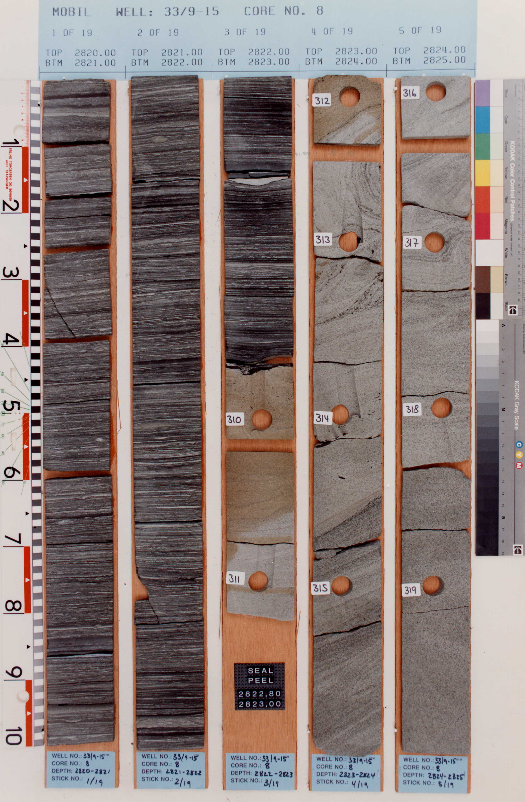
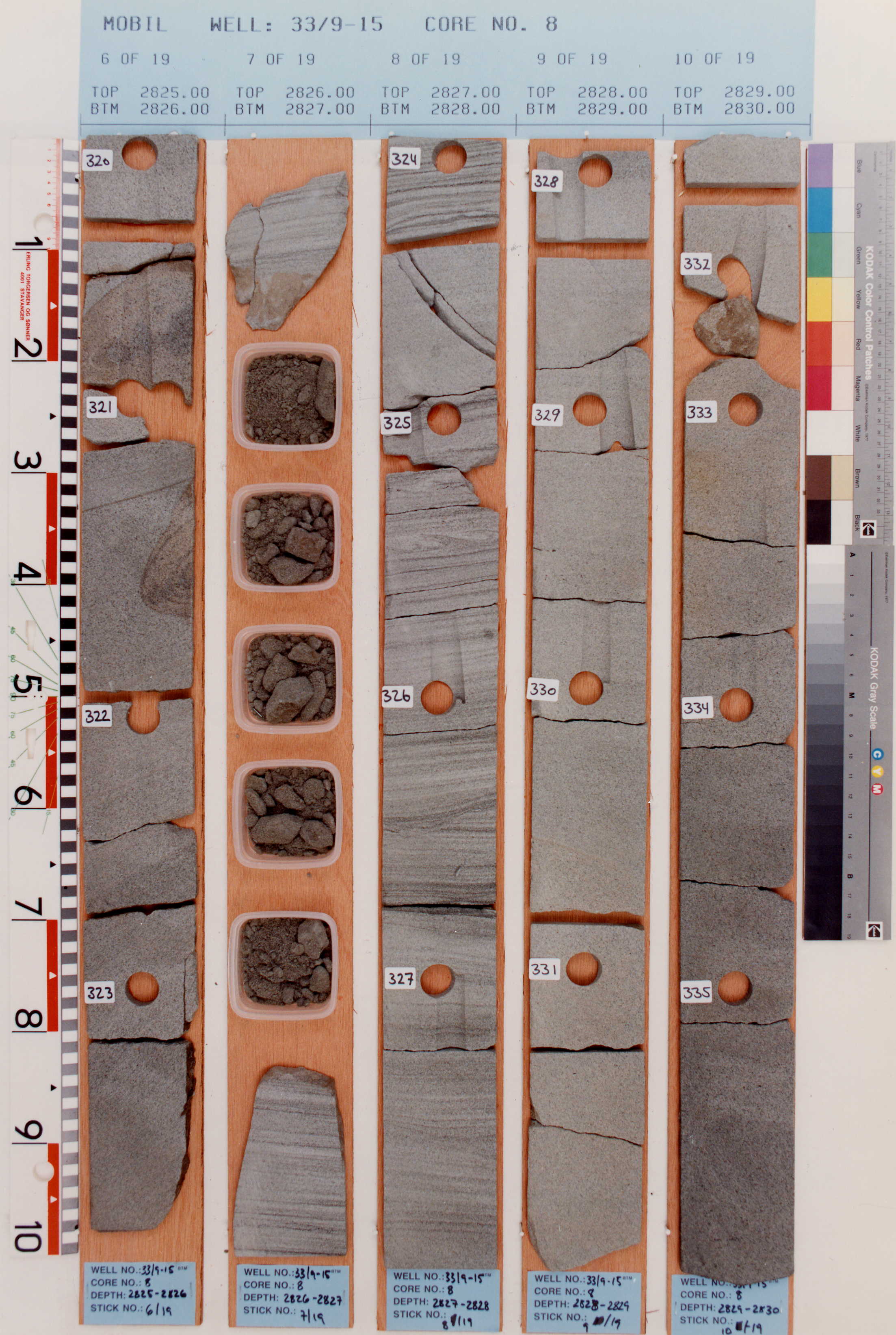
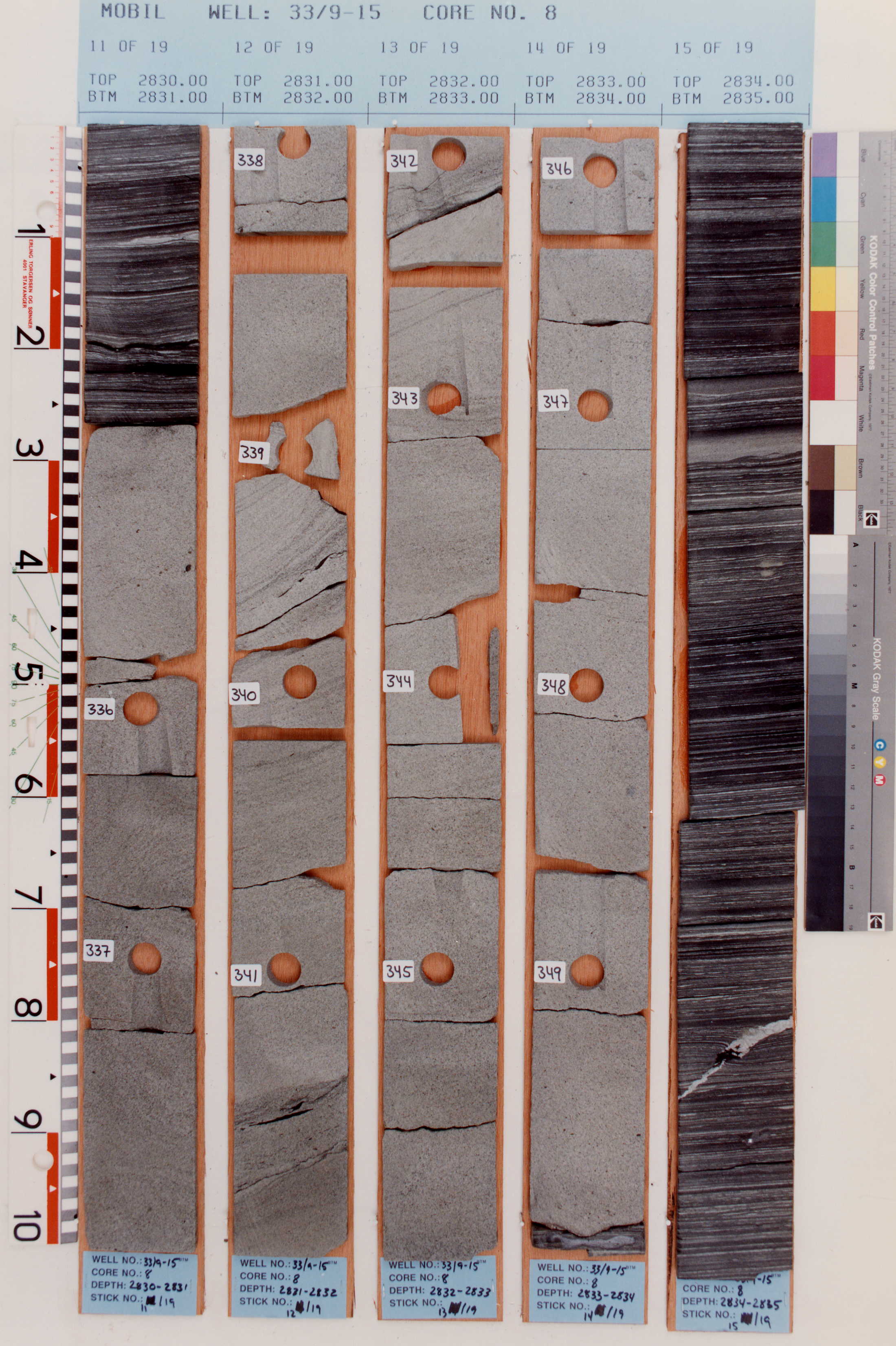
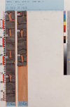
Core photos from type well (from NPD)
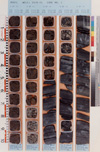
2711-2716 m |

2716-2721 m |

2721-2722 m |
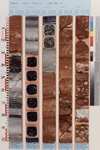
2723-2728 m |
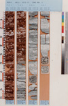
2728-2731 m |
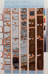
2733-2738 m |
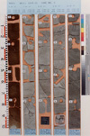
2738-2743 m |

2748-2753 m |
2531-2758 m |
2758-2763 m |
2763-2768 m |
2768-2769 m |
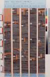
2770-2775 m |

2775-2780 m |

2780-2783 m |
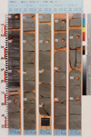
2788-2793 m |

2793-2798 m |

2798-2800 m |

2801-2806 m |
2806-2807 m |
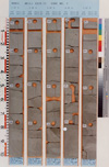
2811-2816 m |

2816-2820 m |
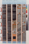
2820-2825 m |

2825-2830 m |
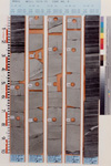
2830-2835 m |
Reference wells
Norwegian well 33/9-16.
Depth 2684-2748 mRKB. WGS84 coordinates N 61°23'28.81"; E 1°57'01.93".
UTM coordinates 6806990.41 N, 443937.38 E, zone 31.
Norwegian well 33/9-17.
Depth 3050-3131 mRKB. WGS84 coordinates N 61°27'18.58"; E 1°50'45.79".
UTM coordinates 6814193.73 N, 438481.99 E, zone 31.
Norwegian well 34/7-21.
Depth 2508-2569 mRKB. WGS84 coordinates N 61°17'36.84"; E 2°4'21.14".
UTM coordinates 6796001.43 N, 450299.76 E, zone 31.
Norwegian well 34/7-21 A.
Depth 2874-2920 mTVD. WGS84 coordinates N 61°17'36.84"; E 2°4'21.14".
UTM coordinates 6796001.43 N, 450299.76 E, zone 31.
Lithology
The Munin Member consists of interbedded fine to medium grained sandstone and dark grey to black
shales. In the type well this member covers two intervals, the lower comprises sharp based sands, the
upper gradual coarsening upwards sands. The two units are inferred as a lower gravity flow sand
intercalated with the Draupne Formation typical black shales, while the
upper unit comprises prograding shoreface sandstones.
Upper and lower boundaries
In the type well the lower boundary shows a sharp transition from black shales to medium grained sand.
Laterally, the lower gravity flow sands may not be developed, and the lower boundary of the Munin
Member will show a gradual transition from black shales into sands.
The upper boundary in the type well is marked by a sharp transition from medium grained sand to black
shale.
Wireline log characterization
On the gamma ray the base of the Munin Member is characterized by a marked decrease in API from the
underlying high gamma shales. The density log shows an abrupt upward decrease. The transit time (DT)
shows and upward increase, while there is little change in the Neutron response. Repeated box formed
lows with variable thickness in the gamma log separated by high gamma thin intervals haracterise the
lower gravity flow dominated unit. The upper unit shows a gradual upward decrease in gamma response
into a continous low gamma interval. The top of the member is characterized by a marked increase in
gamma response (above 100 API). The density and the inverse transit time logs parallel the gamma log
except for scattered carbonate cemented horizons which induce high peaks on the density log and low
transit time on the DT log.
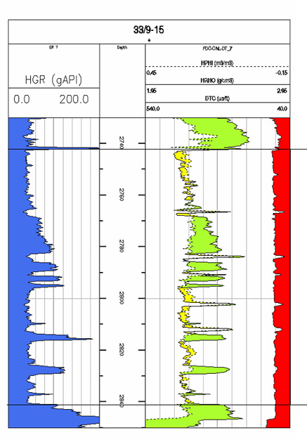
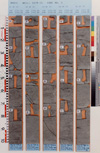
Wireline logs of the Munin Member in type well 33/9-15.
|
Thickness
98 m in type well; varies from 46 to 81 m in the reference wells.
Seismic characterization
Age
Kimmeridgian to Ryazanian.
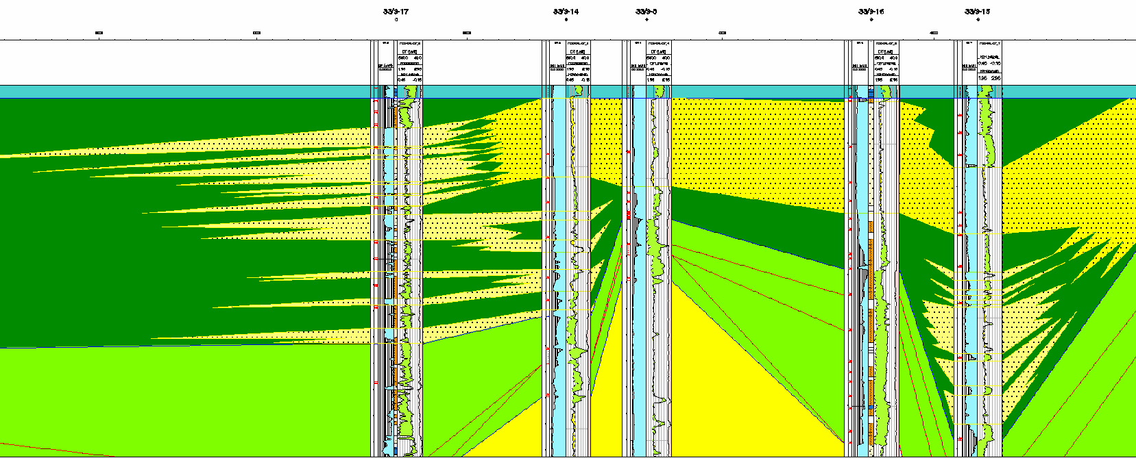
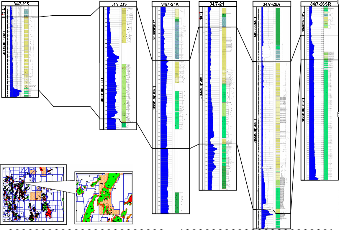
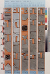
Correlation and subdivision
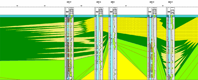

Correlations of the Munin Member.
|

Correlations of the Munin Member.
|
Geographic distribution
Shallow marine sandstones occur along the Tampen Spur in the Snorre-Statfjord area as a result of
footwall uplift and erosion during the early phase of rifting in the North Viking Graben (Gradijan and
Wik, 1987; Solli, 1995; Dawers et al., 1999).
The Munin Member is distributed along the gentle limbs of rotated fault blocks in the Tampen area. The
lower, gravity flow unit, occurs generally further downflank than the upper shallow marine, shoreface
unit. The lower unit is not always present in upflank positions, while the upper unit might be lacking
in downflank wells.